


The GEO Trail shows hikers the origin of the Alps in a simple way Time travel through the Alps

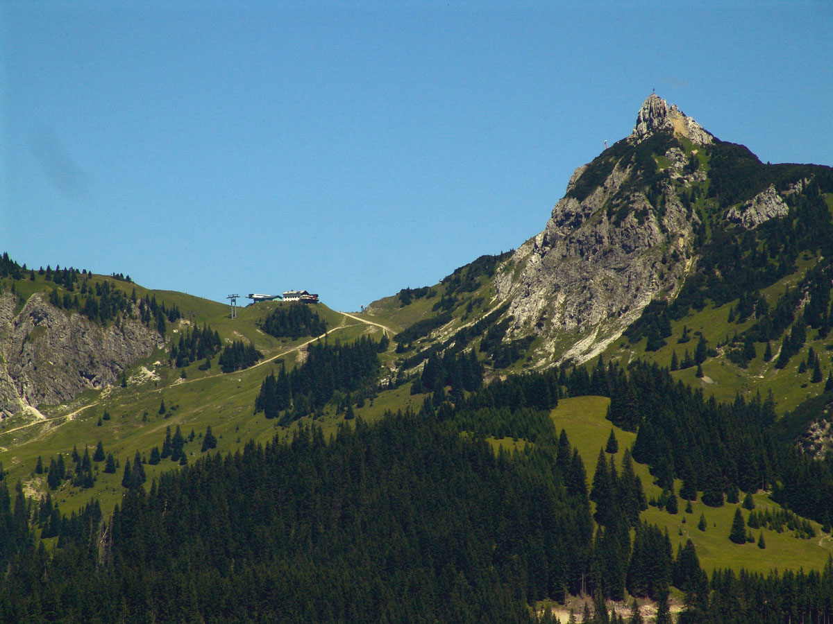
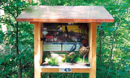
The border between Austria and Germany runs through the Pfronten, Gräner and Vilser mountains. This mountain range is one of the most geologically complex regions of the Northern Limestone Alps. To date, not all geological questions have been answered satisfactorily. We invite you to an exciting geological hike through the history of the earth. Information boards at the various stations provide information about geology, mountain forests, ice and water – in other words “the development of the mountains”. The geo-path has 31 stations and is divided into four Hikes:
Hike 1 – “Pfrontener Pfad” – Station 1-9 from the top station of the Breitenbergbahn to the Kissinger Hütte
Hike 2 – “High Mountain Trail” – Station 10-17, Bad Kissinger Hütte to Vilser Alm
Hike 3 – “Vilser Pfad” – Station 17-23 Vilser Alm/ Municipality of Vils (Hammerschmiede)
New: Hike 4 – “Gräner Pfad” – Station 24 – 31.
The Breitenberg-Füssener Jöchle geological panorama trail from the Breitenbergbahn mountain station to the Kissinger Hütte, then further along the Tannheimer Höhenweg to Grän. At the ticket offices of the Breitenbergbahn or Füssener-Jöchle-Bahn you can buy combined hiking tickets, i.e. e.g. ascent with the Breitenbergbahn and descent with the Füssener-Jöchle-Bahn, then back with the bus to the valley station of the Breitenbergbahn in Pfronten.
The hike 1-3 is also suitable for a day trip. The entire route leads from the mountain station of the Breitenbergbahn via the Kissinger Hütte, Seben Alm to the Vilser Alm, and on to the municipality of Vils. Via the plant path you reach the valley station of the Breitenbergbahn.
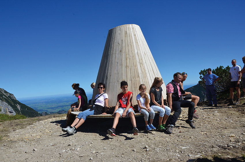
The sun panorama hat
The “Kuckst Du – Sonnenpanoramahut” is only a few minutes’ walk from the mountain station. It weighs 880 kg and is made of oak wood mounted on a metal frame. The construction measures 3.70 metres in diameter in the form of a hat and is a remarkable 2.90 metres high. Similar to a children’s carousel, you can sit on the hat brim and turn the sun panorama hat. Thus one gets the full all-round view and can look down into the beautiful Tannheimer valley or enjoy the free view out into the Allgäu.
Further information
Departure towards the hut
As early as June, most mountain huts will be open again for mountaineers, climbing enthusiasts, hikers and mountain bikers. The Alpine Club provides valuable tips for a successful start to the summer in the mountains. The Alpine Club huts in this country are looked after by both the Austrian (ÖAV) and the German Alpine Association (DAV).
Some of these huts are only now awakening from their hibernation. In July the last huts welcome the hikers again.
Cabin information
On the homepage of the Alpine Club (www.alpenverein.at) under the tab “Berg aktiv” all Alpine Club huts, their opening hours and contact addresses are clearly summarised. Depending on weather conditions, these dates may also change at short notice. It is therefore advisable to ask the landlord before starting the planned tour.
Preparations for tours
Mountain hiking is endurance sport, coupled with a pleasurable experience of nature, and can have a positive effect on body and mind – assuming good physical condition and realistic self-assessment of condition and ability. For the first tours it makes sense to choose easier destinations so that the body can get used to the stresses and strains. A moderate pace is particularly important, so that no one in the group gets out of breath too much. In addition, breaks should be taken regularly.
With increasing condition the difficulties can then increase. In top form you can then also tackle some of the numerous Außerferner two thousand metre peaks.
